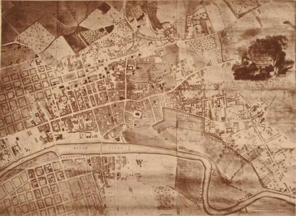
This photograph is another fac simile on a much reduced scale, of a map of Glasgow, by Peter Fleming, an eminent land surveyor, dated in 1807. It is thirty years later than Barrie's. Great changes will be observed to have taken place during that comparatively short space. The population had more than doubled. A considerable number of additional streets had been formed, many of which were wholly or partially built up, while in other places, what had been represented by Barrie as corn fields in his day, were now laid off, and intended for building purposes.
Thus it will be seen that the whole space between the backs of the houses on the north side of the Trongate, north to what is now George Square, and George Street, had been converted into streets. Of these may be noted Hutchison, Brunswick, Wilson, Ingram, Hanover, Frederick, Cochrane, Montrose, George, and Glassford Streets, with a second Square, George's.
Towards the north-west, the lands of Blythswood appear laid off in rectangular streets, but as yet only in skeleton.
On the south side of the river, also, something of the same kind is represented, viz., a few buildings, and a number of incipient streets. Other contrasts between the two maps of Barrie and of Fleming are sufficiently obvious, without requiring further comment.
Back to Contents